40th anniversary of the Wealdway
Jim Carley from MDFG was the inspiration behind the creation of the Wealdway. Having devised the Gravesend to Tonbridge section, he then gained the support of the Ramblers to develop the rest of the route.
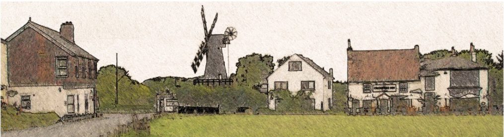
The Wealdway is a long-distance path running for 82 miles north-south across Kent and Sussex from Gravesend to Eastbourne. It crosses not just the fine scenery of the High and Low Wealds but also the North Downs, the South Downs and the Greensand Ridge.
The High Weald is arguably the finest walking country in the South East with its characteristic sandstone outcrops and mediaeval landscape. Small farms, arable fields, pasture and woodland cut by steep-sided ghylls make every walk a delight, marred only slightly in winter by the glorious Wealden mud! The ancient timbered buildings, especially the Wealden Hall House, add much to the landscape, as do the furnace and hammer ponds that are relics of the Tudor iron industry.
September 2021 marked the 40th anniversary of the Wealdway. For the Wealdway40 celebration, eight Ramblers groups and MDFG hosted a total of more than 20 guided walks along sections of the Wealdway during September.
The Wealdway passes Tonbridge Castle at the Medway bridge in the centre of the town. Here the anniversary was marked with a short ceremony on Sunday 26 September. Guests included the Mayor of Tonbridge, Councillor Roger Roud, and Malcolm McDonnell, member of Ramblers’ national Board of Trustees and a member of Sussex Ramblers. Following the ceremony, three groups of walkers set off from Tonbridge Castle on walks of 1.5 miles, 6 miles and 15 miles to complete the day’s festivities.
Saving spaces (by Kate Ashbrook, General Secretary, the Open Spaces Society Never have our local spaces and paths been more important, as we stay at home during lockdown. And it is because of the Open Spaces Society’s work over the last 155 years that we have so many spaces to enjoy.
We were founded in 1865 to fight for commons in and around London—Hampstead Heath, Epping Forest and Wimbledon Common for instance, but over the ensuing years we embraced the whole of England and Wales and we champion village greens, other open spaces and public paths too. And now these precious spaces are threatened more than ever from development, austerity and the Government’s plans to destroy the planning system.
One means of protecting an open space is to register it as a town or village green and the society has led the charge to achieve this. We ask communities to identify those areas of open space which people have used for informal recreation, without permission or challenge, for 20 years. They must then gather evidence of use and apply for the land to be registered as a green, thereby saving it from development and securing the rights of local people to use it for ever. Are there any such spaces in and around Meopham? Once the land is threatened with development it is too late, so this is an urgent call for action.
In addition, you might persuade a beneficent landowner to dedicate land as a green for community use – Kent has set a fine example here. Canterbury City Council voluntarily registered three acres of Kingsmead Field in 2019 and East Malling and Larkfield Parish Council (a member of our society) registered four greens in the last five years, most recently six acres of Whimbrel Green within a housing estate.
The society took up over one thousand cases last year on behalf of members and others and our local correspondents dealt with many more. How we miss our Kent champion, your very own Pat Wilson, who spearheaded many campaigns for us and will always be remembered for her dedication, determination and feistiness! We greatly value the support of your organisation and hope that we can continue to work together for many years to come.
Ramblers’ Don’t Lose Your Way campaign Over 49,000 miles of ‘lost’ paths in England and Wales (footpaths, bridleways and byways) have been rediscovered by the thousands of volunteers who took part. Nearly 1400 miles of these lost paths are in Kent. Identifying potential lost rights of way is just the start of a long process to put them back on the map before they are lost for ever. The Ramblers won’t be able to save all the paths identified so they will focus on those that bring the greatest benefit to the footpath network. There are four more steps to saving them: <br>- Prioritise those paths which add the most benefit for people. <br>- Research individual paths to find out if they can be saved. <br>- Build applications based on historical evidence. <br>- Submit applications by 1st January 2026.
For more information, visit ramblers.org.uk/get-involved/campaign-with-us/dont-lose-your-way-2026.aspx
To become a Don’t Lose Your Way volunteer and get involved with these next steps, then email DLYW@ramblers.zendesk.com
If you see a sheep lying on its back ….Although they may look amusing, if a sheep is left in this position it can lead to a slow uncomfortable death and clearly makes them extremely vulnerable to predators. Once in this position they can’t get back on their own. So, if you see a sheep lying on its back, roll it over from the side and get it back on its feet as soon as possible as you may save its life! This is particularly common at this time of year, when the sheep are pregnant.
what3words: The app that can save your life
The police have urged everyone to download a free smartphone app they say has already saved lives.
what3words points to a very specific location. Its developers divided the world into 57 trillion squares, each measuring 3m by 3m and each having a unique, randomly assigned three-word address.
If you get lost while walking, or someone is injured or taken ill, you can use the app to find your position and tell the emergency services the three words the app has assigned to your location. It cuts out all ambiguity about where you are. The app does not need a phone signal as it uses GPS – and calls to the emergency services use the signal of any available network.
The app also has other uses. For instance, if you can’t find somewhere, ask someone who is there to download the app and give you their three-word location so you can use the app to take you there. Walks leaders who are starting from a place which may be difficult to find could include its three-word location in their walk details.
Taking care of yourselves and others
Our walks leaders and backmarkers take great care with the planning and execution of their walks but anyone taking part in our walks is responsible for their own safety and that of the rest of the group:
- Please make sure you don‘t lose sight of the person in front or you may get left behind
- Please wait before crossing roads until the whole party has caught up and follow the instructions of the walk leader and backmarker
- Please read the Risk Assessment for Group Walks – it’s there to keep you safe!
- Allow leaders to follow their planned route – members should only intervene if help is requested.
Be tick aware!
Lyme Disease is now reported to be particularly prevalent in our part of the country.
To reduce the risk of being bitten by a tick while walking:
– cover your skin and tuck your trousers into your socks
– use insect repellent containing DEET
– stick to paths whenever possible
– wear light-coloured clothing so ticks are easier to spot
– check clothing as ticks can hide and bite on a later occasion
Remove ticks as soon as possible.
See a GP if you’ve been bitten by a tick or visited an area in the past month where ticks are found and you get flu-like symptoms or a circular red “bull’s eye” rash.
There is more advice here:
https://www.nhs.uk/conditions/lyme-disease/
https://www.ramblers.org.uk/news/blogs/2017/august/tick-awareness-blog.aspx
Useful walking website
You may not have come across this very useful website www.walkinginengland.co.uk. It has sections for every county in England, giving links to many walks and walking books in each area. MDFG now has a page in the Kent section.
What to do if cows react to your presence when walking through a field
This is the advice given by The Ramblers:
- Move quickly and quietly
- If possible, walk round the animals
- If they walk towards you, they will normally stop before they reach you
- If they start to follow you, walk on quietly
- If cattle are blocking a route and you think there may be danger, you are allowed to find another way round and then rejoin the footpath as soon as you think it is safe to do so
- Report any problems to the relevant highway authority, who have a duty to defend your right to use a footpath
Consultation on Kent’s footpaths and bridleways
Kent County Council’s consultation on its Public Rights of Way strategy for the next 10 years closed on 12 September 2018.
Old Chalk New Downs Project
In July 2017, this Kent County Council project to improve, restore and reconnect threatened chalk grassland habitats in and around the Kent Downs Area of Outstanding National Beauty was given permission to begin by the Heritage Lottery Fund. For full details of this project please see the Heritage Lottery Fund press release at www.hlf.org.uk
Plantlife will be leading a 3½ mile walk on Sunday 22 July to find and identify butterflies of Ranscombe’s downland meadows and woodlands. For more details please visit http://www.oldchalknewdowns.org.uk/blog/chalkland-events-2018
A range of workshops teaching practical skills, species identification and survey techniques is being offered. These will include an annual workshop for owners and managers of land within the project area on how to manage their land for the benefit of bees and other pollinators. There will also be a variety of free training sessions for anyone interested in helping care for our precious chalk downland – with subjects such as pollinator survey techniques, invertebrate and wildflower study and more practical topics such as brushcutter training.
Details of the available courses can be obtained from the Project Outreach Officer on 03000 419486. You can also sign up to the Explore Kent newsletter – if you tick your interest in Old Chalk New Downs you will be sent monthly inspirational ideas, priority events and details of the free workshops.
The Women’s Land Army: Was your mother or grandmother one of the women recruited to work full-time on the land in World War 1, to help replace men who had left to fight in the war? As part of their environmental project, showing the heritage value of our landscape, the OCND Project is appealing for photographs and stories for their research into these forgotten women. Please contact hilary.hunter@kent.gov.uk.
Help our hedgerows: Hedgerows (some of them historic or ancient) divide up our landscape, preventing livestock from wandering and defining parishes and estates. They also provide shelter and a rich larder for wildlife. Over the next three years the project, with the help of volunteer surveyors, will assess the health of much of this precious habitat. If you would like to attend a training course and carry out a survey please contact matthew.pitts@kent.gov.uk.
What to do when a path through a field is blocked by crops
If the public right way through a field is impassable due to an obstruction, you are legally allowed to take a diversion. If the whole field is cropped, including the public right of way, and only the margin is not cropped, the only possible diversion is via the field edge. The farmer has a duty to prevent a crop (other than grass) from making the path difficult to find or follow. You have the right to walk through crops growing over a path and, provided you stick as closely as possible to the correct line, you should not be liable for any damage caused to the crops.
[reproduced by permission of walk, the magazine of the Ramblers]
Using a mobile phone when you get into difficulties
Instead of dialling 999, use 112 to contact the emergency services as it can even be used on locked phones and will search all available mobile networks to find the strongest signal.
If you also register with the 112 network (I have – just text ‘register’ to 112) you can send a text to 112 if the signal is too poor to make a phone call.
Useful apps which are free to download:
I.C.E.
This allows you to enter emergency contact details, blood type and allergies. (Requests have been made to the creator of the app to be able to add more than one contact and to be able to add medical conditions and medications.) Even if your phone is locked, the widget can be opened to access your emergency information.
GPS OS Grid Reference finder
This app uses GPS (so no internet connection is required) to automatically find the OS grid reference of your current location. Not only does this provide accurate information if required by the emergency services – it also shows where you are on the map if you’ve wandered off course!
Emergencies
You never know when something might happen to you while you’re out walking. If you keep emergency contact numbers in your backpack, this will help walks leaders or the emergency services to contact your nearest and dearest in the event of an accident or other emergency.
ICE (In Case of Emergency)
If you enter emergency contacts in your mobile phone address book under the names “ICE1”, “ICE2” etc this will help walks leaders or the emergency services to contact your nearest and dearest in the event of an accident or other emergency.
Your phone must be unlocked and working to make use of this service.
The Deregulation Bill
This bill, which contains key proposals from the Natural England Stakeholder Working Group on unrecorded rights of way, has a cut-off date of 2026. Any historic path that’s not on the definitive map by then will be left off it. If any of you are aware of any such unrecorded but historic routes please let Steve Bainbridge know.
 Sad News – Mike Groom has died
We are very sad to report Mike’s death on 7 January 2015. He was a valued member of our committee and created and managed our website. His contributions to the Group will be greatly missed.
Pat Wilson Memorials
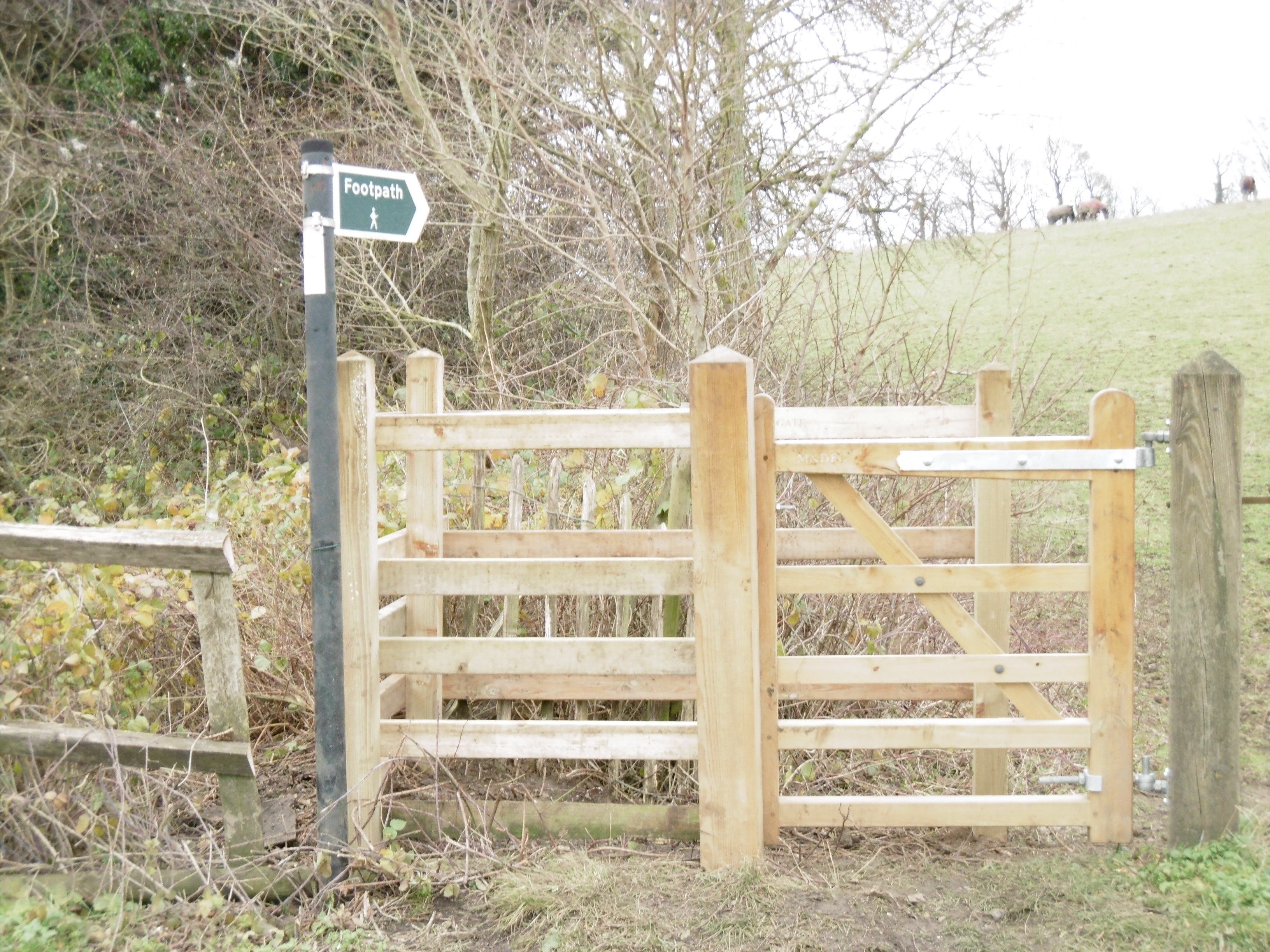 The Meopham & District Footpaths Group’s memorial – a wooden kissing gate – has been erected on the footpath from Meopham Green to Priestwood, at the junction with Whitehill Road. On 3 May 2015 a memorial walk visited the gate, where Pat’s granddaughter Emily and daughter Hilary read the poem written by Alan Smith in tribute to Pat.
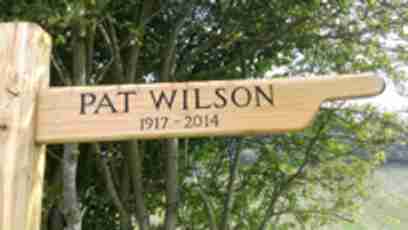
The Luddesdown Group has also erected a memorial to Pat.
Stephen Mulvaney kindly sent us this photo.
For details of Pat’s life and achievements please see the dedicated page.
2014 Meopham Parish Paths Survey
Ken and his trusty band have completed the annual survey of all the Rights of Way in Meopham, which can be seen on the Survey page. Walking all the paths in Meopham with clipboard in hand is no mean feat. Ken and his team should be congratulated for their effort. We all benefit from this work and it is much appreciated by the Parish Council.
The Lost Roads of Meopham
In 1971 Jim Carley published a booklet “The Lost Roads of Meopham”. One of our members, Michael Norman, has diligently walked all the original routes to bring the work up to date. “The Lost Roads of Meopham – Forty Years On”.
Gravesham Rights of Way Committee (GROWC)
This committee has been established for many years. As many members are not aware of its existence, Ken Dare has produced these notes.
GROWC is a broadly based and flexible organisation. Its objects are to promote and facilitate the use of public rights of way in the Borough of Gravesham and its surrounding areas. It places importance on encouraging co-operation between statutory and voluntary bodies. Membership is open to any voluntary or statutory organisation in the Gravesham area interested in public rights of way. National and Regional bodies may also send a member. Local Parish and Gravesham Borough Council join the meetings and play an active and informative part.
Meetings are held in February, June and October. Special meetings may be held if required. Subjects coming before the Committee are exceptionally diverse. Items range, for example, from footpath and bridleway matters to the Gravesham Core Strategy and the proposed new Thames crossing – and so much more.
Meopham and District Footpaths Group is represented on the Committee and also represents Meopham Parish Council in the capacity of its Footpaths Wardens. We value the opportunities provided by our membership of GROWC.
New Online Picture Gallery
We collect far too many photos to show in our newsletter or on this site but they are all added to our Picasa Web page after publication of each quarterly newsletter. Here you will find albums dedicated to the North Downs long distance walk, group holidays and social events as well as pictures taken on some of our walks.
If you are a member and would like to add your own photographic talent to the gallery please contact Mags Bown at
publicity [at] meopham-walkers [dot] co [dot]uk.